
- komal sharma
- 09 Aug 2026
Bihar flood-affected districts 2026: Latest Status, Alerts and Safety Tips
Bihar is experiencing active monsoon conditions in August 2026, with rainfall continuing across several parts of the state. On August 9, reports indicated a yellow alert for rain and lightning in 20 districts, while the state was also facing a significant rainfall deficit.
The flood situation is particularly important in North Bihar, where rivers such as the Bagmati, Kosi, Gandak, and Mahananda can rise quickly after heavy rainfall and upstream water flow.
On August 7, the Bagmati River was reported to be flowing above the danger mark near Muzaffarpur, prompting the local administration to remain on flood alert.
If you are searching for the Bihar flood-affected districts in 2026, it is important to understand the difference between districts that are currently Bihar flood-affected districts that are under flood watch and districts that are historically flood-prone.
Important: Flood conditions can change within hours. A flood-prone district is not automatically a currently Bihar-flood-affected district. Always check the latest official information before making travel or safety decisions.
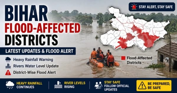
Bihar flood-affected districts 2026: latest situation
The flood situation in Bihar depends on several factors, including rainfall, river water levels, upstream rainfall, drainage conditions, and the location of vulnerable settlements.
Muzaffarpur is currently an important district to monitor because the Bagmati River was reported above its danger mark on August 7. Reports said that continuous rainfall in parts of Nepal contributed to rising water levels in major North Bihar rivers. This makes Muzaffarpur an important area when tracking Bihar flood-affected districts
However, this does not mean that the entire Muzaffarpur district is flooded. Flooding can affect individual villages, blocks, agricultural areas, and low-lying settlements while other parts of the same district remain unaffected.
For this reason, a reliable Bihar flood-affected districts list should always be accompanied by the latest river, rainfall, and district-level information.
Bihar flood-affected districts List 2026
Several districts in Bihar are considered vulnerable to flooding because of their geography, river systems, and historical flood patterns.
Important flood-prone and flood-monitoring districts include:
- Muzaffarpur
- Sitamarhi
- Sheohar
- Darbhanga
- Madhubai
- Supaul
- Saharsa
- Khagaria
- East Champaran
- West Champaran
- Araria
- Purnia
- Katihar
Important:
This should not be interpreted as a claim that all these districts are currently flooded on August 9, 2026. They are included because they are important flood-risk or monitoring areas.
Current affected areas should be verified through the latest district administration, river-level, and weather information. This distinction is important when identifying Bihar flood-affected districts.
Flood-Prone vs Currently Flood-Affected Districts
This distinction is extremely important when discussing Bihar flood-affected districts in 2026.
What is a flood-prone district?
A flood-prone district is an area that has a higher risk of flooding because of rivers, low-lying terrain, drainage conditions, or historical flood patterns.
What is a currently flood-affected district?
A currently flood-affected district has verified evidence of flooding, waterlogging, or significant flood impact during the current event.
Therefore, an old flood record should not automatically be presented as evidence that a district is flooded today. This is important when identifying Bihar flood-affected districts.
Muzaffarpur Flood Alert 2026
Muzaffarpur is one of the districts receiving particular attention because the Bagmati River was reported above the danger mark on August 7.
The report said rising river levels prompted the administration to remain on flood alert.
Residents in riverbank and low-lying areas should closely monitor official announcements, rainfall forecasts, and river-level information.
At the same time, crossing a danger mark does not mean that every part of the district is underwater. Local flood impact depends on the exact location, drainage, embankments, and water flow. This is why Bihar flood-affected districts should always be identified using the latest local information.
Bihar Flood Alert Today: What Should Residents Check?
If you live in or near a flood-prone area, check these factors regularly:
- Latest rainfall forecast
- Nearby river water level
- River warning and danger levels
- District administration alerts
- Road and bridge conditions
- Evacuation announcements
- Relief camp information
For weather forecasts and warnings, the India Meteorological Department (IMD) should be one of the primary sources.
Official source: India Meteorological Department (IMD)
Major Rivers Driving Flood Risk in Bihar

Understanding Bihar’s major rivers is important when tracking the Bihar flood-affected districts’ situation.
Kosi River
The Kosi is one of Bihar’s most important flood-sensitive river systems.
Areas around Supaul, Saharsa, Madhepura, and Khagaria can face increased flood risk when river levels rise significantly.
Upstream rainfall can also affect downstream water levels.
Bagmati River
The Bagmati is particularly important for North Bihar.
The recent Muzaffarpur alert shows why the river requires close monitoring during periods of heavy rainfall. The river was reported above its danger mark near Muzaffarpur on August 7.
Gandak River
The Gandak is important for flood-risk monitoring across parts of northern and western Bihar.
Heavy rainfall in its upstream catchment can contribute to increased downstream water levels.
Mahananda River
The Mahananda basin is important in northeastern Bihar, including areas around Purnia and Katihar.
Heavy rainfall and rising river levels can increase the risk of flooding and waterlogging in vulnerable locations.
Kamla-Balan River
The Kamla-Balan river system is important for northern Bihar, particularly around Madhubani and surrounding areas.
Changes in river levels during the monsoon require close monitoring.
Ganga River
The Ganga also plays an important role in Bihar’s overall flood situation.
When the Ganga rises while tributary rivers are already carrying large amounts of water, drainage from low-lying areas can become more difficult.
Bihar River Water Levels: Why They Matter
A river being described as “rising” does not automatically mean that flooding has occurred.
The important question is how the current water level compares with the river’s warning and danger levels.
Below Danger Level
The river is below its official danger mark, but continued rainfall may still require monitoring.
Near Danger Level
People living near the river should pay closer attention to official updates.
Above Danger Level
The risk can increase for nearby low-lying and riverbank areas, particularly if rainfall and upstream flows remain high.
For official river and flood monitoring information, check the Central Water Commission (CWC).
Official source: Central Water Commission (CWC)
The Bihar Water Resources Department also provides information related to the state’s rivers and flood-management activities.
Official source: Bihar Water Resources Department
Bihar Heavy Rain and Flood Alert 2026
Heavy rainfall is one of the major factors that can increase flood risk, but rainfall alone does not determine whether a district will flood. This is important when identifying Bihar flood-affected districts.
The impact depends on:
- Amount of rainfall
- Speed of rainfall
- Existing river levels
- Upstream rainfall
- Soil saturation
- Drainage capacity
- Local geography
As of August 9, reports indicated continued monsoon activity in Bihar, with a yellow alert for rain and lightning in 20 districts.
Residents should therefore monitor both weather forecasts and river water levels instead of relying on only one source.
Bihar Flood-Prone Areas: Who Is Most at Risk?

Some locations are naturally more vulnerable to flooding.
Riverbank Communities
Settlements close to rivers can experience rapid changes in water levels.
Low-Lying Villages
Low-elevation areas may accumulate water more quickly during heavy rainfall or river overflow.
Areas Near Embankments
Residents near embankments should follow official warnings and evacuation instructions.
Waterlogged Urban Areas
Heavy rainfall can cause urban flooding when drainage systems cannot remove water quickly enough.
Agricultural Areas
Floodwater can damage crops and farmland even when nearby residential areas remain relatively safe.
Bihar Flood Safety Tips
Flood preparedness should begin before water reaches homes and roads. This is especially important in Bihar flood-affected districts.
Before a Flood
Keep the following items ready:
- Drinking water
- Dry food
- Essential medicines
- Flashlights
- Power banks
- Important documents
- First-aid supplies
- Essential clothing
Keep important documents inside waterproof bags.
During a Flood
Avoid unnecessary travel.
Never attempt to walk or drive through fast-moving floodwater. Floodwater can hide open drains, damaged roads, debris, and deep sections.
Keep children away from rivers, canals, and flooded roads.
Follow official announcements rather than unverified social-media posts.
If Evacuation Is Ordered
Do not wait until the situation becomes dangerous.
Follow the evacuation route and shelter information provided by local authorities.
Bihar Flood Relief Camps and Emergency Support
During severe flooding, district authorities may arrange temporary shelters, relief camps, food distribution, and emergency assistance. This support is especially important for Bihar flood-affected districts.
However, relief-camp locations and availability can change depending on the situation.
For the latest information, check the following:
- District administration notices
- Bihar disaster-management updates
- Local government announcements
- Official relief-camp information
Avoid relying on old social-media posts for emergency information.
How to Check Bihar Flood Updates
If you want the latest information about Bihar flood-affected districts, use primary sources whenever possible.
India Meteorological Department
Use IMD for:
- Rainfall forecasts
- Heavy-rain warnings
- Weather alerts
- District-level weather information
Central Water Commission
Use CWC for river water levels and flood monitoring information.
Check Central Water Commission updates.
Bihar Water Resources Department
Use the Bihar Water Resources Department for information related to rivers, flood management, and water resources.
Check Bihar Water Resources Department
District Administration
For local information such as evacuation, roads, relief camps, and affected villages, check the latest notices from the relevant district administration.
Bihar flood-affected districts 2026: What Residents Should Remember

Flood conditions can change quickly.
A district may appear relatively safe in the morning but experience waterlogging later if rainfall continues or an upstream river rises.
That is why people should not rely on a static Bihar flood-affected districts list.
Instead, check:
- Current river water levels
- Latest rainfall forecast
- Flood warnings
- District administration updates
- Road conditions
- Evacuation information
This provides a much more accurate picture of the situation.
Frequently Asked Questions
Which districts of Bihar are affected by floods in 2026?
The current list can change quickly. Muzaffarpur has recently been under flood alert after the Bagmati River was reported above the danger mark. Other districts should be verified using the latest official river, weather, and district-level updates. This is important when tracking Bihar flood-affected districts.
Which are the most flood-prone districts in Bihar?
Several districts in north and northeastern Bihar are vulnerable to flooding because of major river systems such as the Kosi, Bagmati, Gandak, Kamla-Balan, and Mahananda.
Is every flood-prone district currently flooded?
No. A flood-prone district has a higher risk of flooding, but that does not mean the entire district is currently flooded.
How can I check the Bihar flood alert today?
Check the latest IMD weather warnings, Central Water Commission river information, Bihar Water Resources Department updates, and local district administration notices.
Which rivers are important during Bihar’s flood season?
Important rivers include the Kosi, Bagmati, Gandak, Mahananda, Kamla-Balan, and Ganga.
Why does rainfall in Nepal matter to Bihar?
Several river systems affecting northern Bihar have catchments extending into Nepal. Heavy rainfall upstream can contribute to increased downstream river levels.
What should I do if floodwater enters my area?
Move to a safer or higher location when instructed, avoid fast-moving water, protect important documents, keep communication devices charged, and follow local administration instructions.
Can old flood data be used for the 2026 affected-district list?
No. Historical data can help explain flood vulnerability, but it should not be presented as proof of current flooding.
Conclusion
The Bihar flood-affected districts’ 2026 situation requires regular monitoring because rainfall and river levels can change quickly.
Muzaffarpur is currently an important area to watch because the Bagmati River was reported above the danger mark on August 7. At the same time, Bihar continues to experience active monsoon conditions, with a yellow alert reported for rain and lightning in 20 districts on August 9. These conditions are relevant when monitoring Bihar flood-affected districts.
However, a flood-prone district should not automatically be described as currently flooded. The most reliable approach is to verify the latest river level, rainfall forecast, district warning, and local administration update.
For the latest Bihar flood-affected districts’ information, readers should regularly check the IMD, Central Water Commission, and Bihar Water Resources Department instead of relying only on old lists or social media posts.
